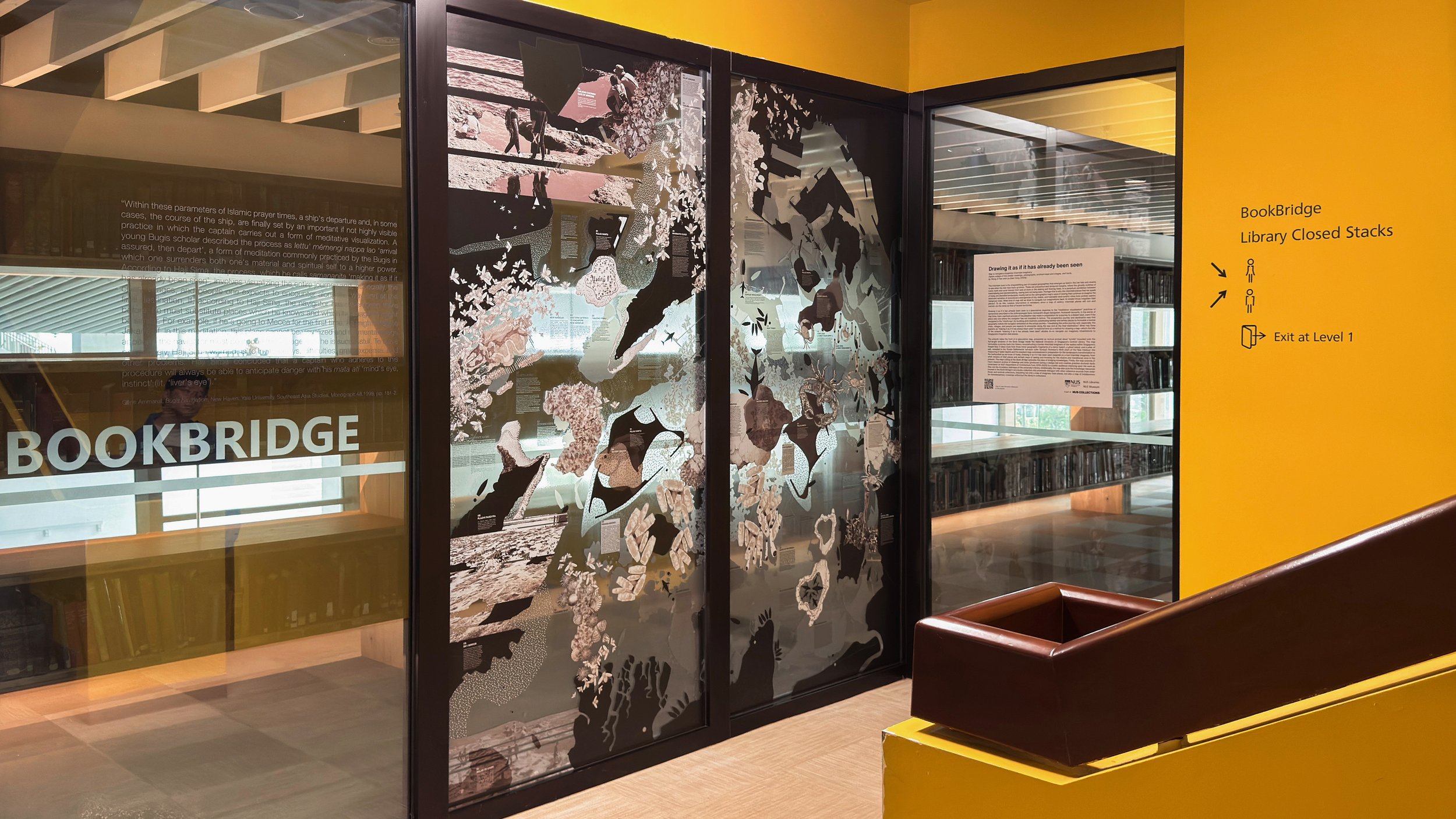
Drawing It As If It Has Already Been Seen
Map-drawing navigating a forgotten intertidal imaginary, by Wong Zihao and Liu Diancong, August 2024. The digital artwork is reproduced in vinyl print and installed at the National University of Singapore’s Central Library Building’s Book Bridge. The work is included as part of Encounters: Exploring New Perspectives, a collection of artefacts, artworks, archival materials, and rare books, created for the purposes of teaching and research. The collection is in the care of NUS Libraries and NUS Museum.
See: https://nus.edu.sg/nuslibraries/encounters/intro-to-encounters
and https://nus.edu.sg/nuslibraries/encounters/drawing-it-as-if.
“[…] a ship’s departure and, in some cases, the course of the ship, are finally set by an important if not highly visible practice in which the captain carries out a form of meditative visualization. A young Bugis scholar described the process as lettu’ memengi nappo lao ‘arrived assured, then depart’, a form of meditation commonly practiced by the Bugis which one surrenders both one’s material and spiritual self to a higher power. According to Haji Sima, the process, which he calls samananita ‘making it as if it has already been seen’, involved visualizing the entire journey and, especially, the cities, villages, and people one expects to encounter along the way and at the final destination. If according, to Haji Sima, the navigator has never been there before, he must substitute places which he knows and which he imagines might be similar. For example, if he’s going to Mecca for the first time, he might imagine Jakarta. If, in this meditation, this place cannot be visualized and no mental image appears, the navigator must propose the voyage until he is successful. To leave prematurely, Haji Sima warned is to invite delays, difficulties, great expense, and other problems. Haji Sima concluded that a captain who adheres to this procedure will always be able to anticipate danger with his mata ati ‘mind’s eye, instinct’ (ie. ‘liver’s eye’).”
— Gene Ammarell, Bugis Navigation, pp. 181-2.
Drawing It
As If…
It Has Already Been Seen
The intertidal zone is the shapeshifting part of coastal geographies that emerges as land in the low tide and reverts to sea when the tide rises back up shore. These are precarious and temporal margins, where the ghostly outlines of rocky reefs and coral islands form and un-form in the ebbing and flowing tides, in a perpetual oscillation between materialising and dematerialising, seeing and not being seen. Perhaps this is why the intertidal places that we speak of today are dwindled landscapes, mostly lost to the cartographic map’s ways of seeing that continue to imagine the dominant narrative of evolutionary emergences of dry, stable, and habitable land-centric cities from archaic watery mangrove roots. What kind of map will we draw to navigate our imaginations back to inhabit those forgotten tidal places? To do this, creative intervention is necessary since a map of watery, intertidal places will not—and cannot—be the same as that of landed territories.
Drawing It As If It Has Already Been Seen is a speculative response to the “meditative visualisation” practices of samananita described in the anthropologist Gene Ammarell’s Bugis Navigation. Ammarell recounts, in the words of Haji Sima, how a spiritual process of visualisation was made in preparation for a journey to a distant land, even if the place was one where the navigator has not travelled to before. The prospective journey and destination was first navigated in the “mind’s eye”, by recalling and creatively substituting familiar and similar places to formulate a mental geography before the navigator embarked on the actual journey—“visualising the entire journey and, especially, the cities, villages, and people one expects to encounter along the way and at the final destination.” What Haji Sima explains as “making it as if it has always been seen” is explored here as a method for drawing a map—which the title of the artwork “drawing it as it has already been seen” alludes to—to navigate our imaginary inhabitations to Singapore’s forgotten tidal places.
The artwork takes the form of a speculative map, presented as vertical printed decal “scrolls” mounted onto the full-length windows of the Book Bridge inside the National University of Singapore’s Central Library. The map formulates a journey back into history, reconstructing a former intertidal imaginary of the waters within Singapore’s Keppel Bay. It takes clues from three minor geographic fragments of a mirror beach, a ghost island, and a pillar of salt, revealed in the Straits Settlements’ surveyor John Turnbull Thomson’s 1849 chart of the New Harbour: the measuring of water depths and the resultant map commissioned in preparation for the landscape’s transformation to the harbourbed as we know of today. Drawing it as if it has been seen expands on a lost intertidal imaginary from what remains of tidal places and archaic ways of seeing and knowing for the elusive and transitional zone in the present. The map’s siting at the Book Bridge activates the idea of bridging knowledges. Firstly, the map extends the author’s research archive of drawings and texts (produced during a design-led and creative practice doctoral study undertaken at NUS’ Department of Architecture from 2019-2023) to a public audience chancing upon the work as they use the circulatory stairways of the university’s library. Additionally, the map also puts the knowledge resources housed in the Book Bridge’s rare books collection into proximate dialogue with other reference sources in the wider library collections, becoming not only a map of imaginary tidal places, but also a map of (re)discovery for transdisciplinary crossings within the library’s collections.


